The full name of AR technology is augmented reality technology, which calculates the position and angle of the camera in real time and adds the corresponding image, video and 3D model technology, that is, the virtual world can be placed in the real world and interacted on the display side. Scenes. The difference with VR technology is that virtual 3D maps are used in VR, while AR is a real-life map. At present, well-known enterprises that use AR technology in the security industry, such as Haikang, Dahua, Gaoxin and other security companies, are not only producing front-end AR cameras, but also using real-life command systems on the back-end platforms. The AR real-world command application is a combination of virtual and real, real-time interaction, three-dimensional orientation, and intelligent analysis technology applied to the entire security control platform.
1. Combination of virtual and real
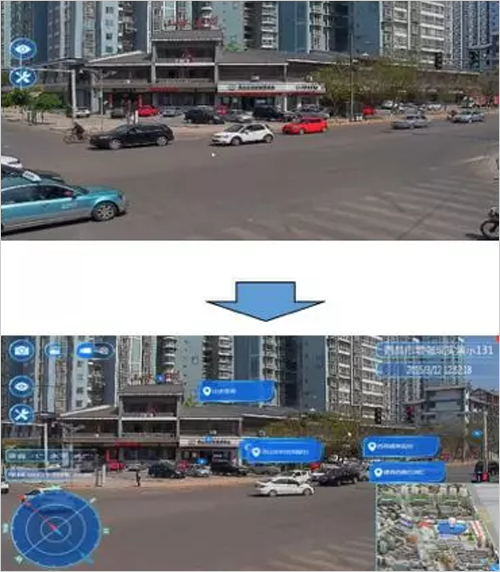
The combination of virtual and real technology is mainly a display interface that uses virtual technology combined with real-life maps. In the past, our camera took a video image without describing the specific location of the video image, the specific building, and the key sections in the corresponding area, and the combination of virtual and real can be used in the video image. Corresponding background labels, as well as corresponding labeling of the corresponding location, buildings, and lots (as shown in Figure 1).

Figure 1 schematic diagram of virtual and real
2. Real-time interaction
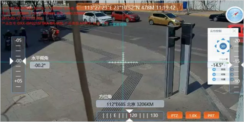
Real-time interaction is to superimpose the functions of the original video surveillance platform in the AR real-life command, and can perform corresponding video review, zoom video, control front-end dome and other functions, and it is controlled in real time. When confirming a detail in the video, real-time interactive technology can be used to enlarge the corresponding position in the video without affecting the content of the AR tag (as shown in Figure 2).

Figure 2 Real-time interaction diagram
Â
3. Three-dimensional orientation
Three-dimensional orientation combines the corresponding technology of latitude and longitude, level and so on into the real-life command platform. The output of a position-aware orientation to the background system can know the position and latitude and longitude of a certain car, a person, and the latitude and longitude of the video captured by this camera. At present, a new technology has been added to measure the height of a person in the video and the distance between the two cars in a video (see Figure 3).

Figure 3 3D orientation diagram
4. Intelligent analysis
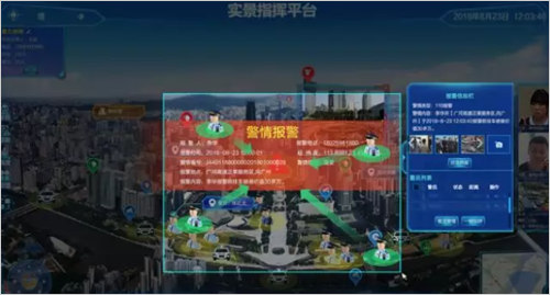
Intelligent analysis technology is combined with the actual use of the public security platform. At present, there are face analysis, vehicle analysis and video structural analysis in the actual application of the public security industry. The characteristic values ​​of personnel and vehicles obtained after analysis are used to assist the police to solve the case. The analysis of people is to extract the characteristics of age, gender, height, face, etc. The analysis of the car is the license plate number, body color, vehicle type, car logo, driver's face, seat belt and other characteristics. After analyzing the big data platform in the background, the corresponding data information is displayed on the real map, and the alarm information can also be displayed on the real-life command platform (as shown in Figure 4).

Figure 4 Schematic diagram of intelligent analysis
emi-auto labeling machine,Automatic labeling machine,wine bottles labeling machine,round bottles labeling machine,Taper bottles labeling machine
Suzhou Flying Man Assembly Automation Co., Ltd. , https://www.flyingmans.com